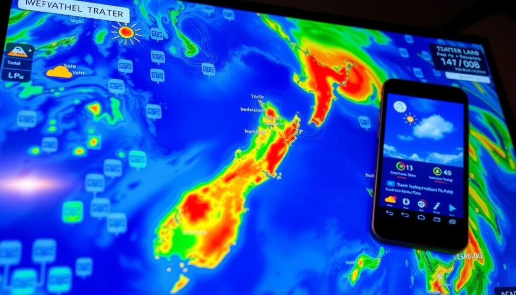
New Zealand Weather Radar: Live Maps, Apps & How to Use
New Zealand’s weather radar comes from one official source, but choosing between MetService and RainViewer can mean the difference between staying dry and getting soaked. The national network refreshes every 7.5 minutes, so knowing which tool to use and how to read the images is the smarter habit.
Update frequency: 7.5 minutes ·
Radar stations: 8 (MetService network) ·
Longest loop: 24 hours ·
Coverage area: Mainland New Zealand and offshore ·
Recent data: Last 2 hours
Quick snapshot
- MetService is New Zealand’s official weather authority and operates the primary national weather-radar service (MetService (national weather authority)).
- The official app bundles real-time rain radar, severe-weather warnings and watches, forecast graphs, three-day rain-forecast maps, and forecasts for more than 3,000 locations (MetService app page).
- RainViewer maps New Zealand radar and names MetService as its radar data source (RainViewer (third-party radar aggregator)).
- Which source is “most accurate” for Queenstown specifically has no published ranking; the official radar guide says a live image is detected precipitation, not a point forecast (MetService radar guide).
- RainViewer’s 15-minute alert timing is an advertised estimate, not a guarantee (RainViewer (third-party radar aggregator)).
- Radar in mountainous terrain needs extra interpretation; official guidance says to pair it with warnings (MetService radar guide).
- The exact update interval for the web radar is not explicitly stated; the radar guide only mentions “real-time imagery plus a last-24-hours view”. (MetService radar guide)
- MetService’s national radar keeps a last-24-hours loop (MetService national radar).
- The recent-data window covers about the last two hours of frames (MetService radar guide).
- Forward-looking views come from three-day forecast maps, not from the radar itself (MetService app page).
- Check official severe-weather warnings alongside the radar before making safety decisions (MetService (national weather authority)).
- RainViewer advertises alerts roughly 15 minutes before rain for selected locations (RainViewer (third-party radar aggregator)).
- MetService’s app pushes severe-weather notifications, so the map does not need to stay open (Apple App Store (MetService iOS)).
Ten rows of radar facts, one pattern: the official source generates the data, and every other tool in this list repackages the same feed.
| Label | Value |
|---|---|
| Official operator | MetService, New Zealand’s national weather authority (MetService (national weather authority)) |
| App forecast locations | More than 3,000 (MetService app page) |
| Rural forecast regions | 29 (MetService app page) |
| Radar update interval | 7.5 minutes in MetService’s rural app (MetService app page) |
| Regional radar views | Ten areas, from Northland to Southland (MetService radar guide) |
| National radar | Yes, with a last-24-hours loop (MetService national radar) |
| Precipitation scale | Light, moderate, heavy, hail (MetService radar guide) |
| iOS app extras | Severe-weather notifications, widgets, traffic cameras, UV, fire ratings (Apple App Store (MetService iOS)) |
| Android forecast areas | 47 icons set by MetService meteorologists (Google Play (MetService Android)) |
| Third-party radar | RainViewer uses MetService data and advertises alerts roughly 15 minutes before rain (RainViewer (third-party radar aggregator)) |
How does New Zealand weather radar work?
MetService, the country’s official weather authority, operates the primary national radar service (MetService (national weather authority)). The public radar maps organize precipitation into an intensity scale and arrange the frames into loops you can play back.
- The official scale runs light, moderate, heavy, and hail, so heavier colours mean more intense rainfall (MetService radar guide).
- Loops matter more than single frames — they show whether a band is approaching, moving away, intensifying, or weakening — and a live frame is detected precipitation, not a point forecast (MetService radar guide).
Radar looks up, not sideways. MetService’s own radar guide says a live image is not a guaranteed point forecast for your address (MetService radar guide), so the closer you get to mountains — Queenstown included — the more the map behaves like a hint than a promise.
Why this matters: radar answers “where is rain right now,” but not “will it reach my street at 4 pm.” The warnings and forecast maps in the next sections are built to fill that gap.
Where can I see live New Zealand weather radar?
MetService’s national and regional maps
- Regional views cover Northland, Auckland, Bay of Plenty, Hawke’s Bay, Taranaki, Wellington, Westland, Canterbury, Otago, and Southland (MetService radar guide).
- A national radar view puts the whole country on one map (MetService national radar).
- The radar page keeps real-time imagery plus a last-24-hours view (MetService radar guide).
Start with the regional map closest to you, then step back to the national view when a front is crossing the whole country (MetService national radar).
Third-party radar views
- RainViewer offers a live New Zealand radar map and identifies MetService as its radar data source (RainViewer (third-party radar aggregator)).
- RainViewer’s New Zealand radar locations include Auckland, Bay of Plenty, Canterbury, Gisborne/Hawke’s Bay, Northland, Southland, Taranaki, Wellington, and Westland (RainViewer (third-party radar aggregator)).
Community and enthusiast sites such as WeatherWatch and MetVuw also appear in radar searches; treat their loops as supplementary views rather than the official record.
The pattern: anyone can repackage radar, but only MetService generates the national feed in the first place — which is why its pages stay the reference point for update intervals and warnings.
Which rain radar apps are best for New Zealand?
MetService app
- Bundles real-time rain radar, severe-weather warnings and watches, 48-hour forecast graphs, three-day rain-forecast maps, forecasts for more than 3,000 locations, and location search via GPS or a typed suburb, town, or city (MetService app page).
- Adds severe-weather notifications, widgets, traffic cameras, UV, and fire ratings on iOS (Apple App Store (MetService iOS)).
- Includes forecast icons for 47 forecast areas set by MetService meteorologists on Android (Google Play (MetService Android)).
The app is available on both iOS and Android, so the same core radar feed reaches both platforms (Apple App Store (MetService iOS); Google Play (MetService Android)).
RainViewer
- Tracks up to 20 locations with individual rain alerts (RainViewer (third-party radar aggregator)).
- Advertises alerts roughly 15 minutes before rain for selected locations (RainViewer (third-party radar aggregator)).
- Free to download, with an optional paid plan from $1.67 per month when billed annually (RainViewer (third-party radar aggregator)).
RainViewer’s edge is timing: it turns the same MetService radar feed into a push notification before a shower arrives. Its weakness is context — a 15-minute ping is less useful than the official warning text when conditions are dangerous (RainViewer (third-party radar aggregator)).
RainViewer wakes you up early; MetService tells you what the situation actually is. When weather turns dangerous, you want both — the alert for timing, the official text for severity.
What this means: MetService’s app is the default, RainViewer is the complement, and installing both costs nothing.
How to check Queenstown weather radar?
Find the right regional view
- Queenstown sits inside MetService’s Otago regional radar view, with Southland as the neighbouring view for storms tracking up from the south (MetService radar guide).
- Set Queenstown as a saved location in the MetService app using location services or a manual search (MetService app page).
- For the wider picture, switch to the national radar map with its 24-hour loop (MetService national radar).
Mountainous terrain is exactly where radar needs the most interpretation; the official guidance stresses that a live image shows detected precipitation, not a guaranteed point forecast (MetService radar guide).
Queenstown’s radar picture can stay deceptively clear right up until a shower forms over the hills. Check the two-hour loop, then read the official warning text, before you commit to outdoor plans.
The catch: in a mountain town, radar is a nowcasting tool, not a crystal ball. The app’s three-day rain-forecast maps cover the South Island and tell you whether real rain is in the pipeline (MetService app page).
What does a 3-day rain radar show for New Zealand?
Rain-forecast maps vs live radar
- The MetService app’s three-day rain-forecast maps show predicted rainfall accumulation for the next three days (MetService app page).
- Live radar shows detected precipitation — what is falling or approaching right now (MetService radar guide).
- MetService’s radar history reaches back through the past day, so no radar feed “predicts” three days ahead (MetService national radar).
When someone asks for a 3-day rain radar, they usually want the forecast map’s visual style with the radar’s immediacy. The app delivers the former over a three-day window; the radar page delivers the latter over the recent past (MetService app page; MetService radar guide).
The trade-off: real-time radar ends at the present moment, while a three-day rain map trades precision for a look ahead. For outdoor plans in New Zealand, check both.
Radar source specs at a glance
Seven ways to view the same national radar, one pattern: the extra features are alerting and convenience, not new data.
| Service | What you get | Recency | Reference |
|---|---|---|---|
| National radar map (web) | Full-NZ view | Real-time imagery plus a 24-hour loop | MetService national radar |
| Regional radar maps (web) | Ten regional views from Northland to Southland | Real-time frames with a 24-hour view available | MetService radar guide |
| MetService app — iOS | Zoomable radar, severe-weather notifications, widgets, traffic cameras, UV, fire ratings | Live radar with official warnings | Apple App Store (MetService iOS) |
| MetService app — Android | Forecast icons for 47 areas set by MetService meteorologists | Live radar with official warnings | Google Play (MetService Android) |
| MetService rural app | Ten-day forecasts for 29 rural regions | Rain radar updated every 7.5 minutes | MetService app page |
| Three-day rain-forecast maps | Predicted rain accumulation for the next three days | Forecast — not a live radar feed | MetService app page |
| RainViewer | Live NZ radar using MetService data; up to 20 tracked locations | Feed follows MetService’s radar updates | RainViewer (third-party aggregator) |
Why this matters: pick the tool that matches the decision — the web radar for a quick look, the app for warnings on the go, RainViewer for a heads-up, and the three-day map for planning.
What’s confirmed, what’s not
Confirmed facts
- MetService operates New Zealand’s official national weather-radar service (MetService (national weather authority)).
- The MetService app bundles real-time rain radar, severe-weather warnings, 48-hour forecast graphs, three-day rain-forecast maps, and forecasts for more than 3,000 locations (MetService app page).
- The rural app states its rain radar updates every 7.5 minutes and lists 29 rural forecast regions (MetService app page).
- Regional radar views cover ten areas across the country (MetService radar guide).
What’s unclear
- Which source is “most accurate” for Queenstown specifically has no published ranking; the official radar guide says live imagery is detected precipitation, not a point forecast (MetService radar guide).
- RainViewer’s “15 minutes before rain” alerts are an advertised estimate, not a verified guarantee (RainViewer (third-party radar aggregator)).
- Coverage in mountainous terrain is uneven, so official guidance says to pair radar with severe-weather warnings (MetService (national weather authority)).
- The exact update interval for the web radar is not explicitly stated; the radar guide only mentions “real-time imagery plus a last-24-hours view”.
The split is useful precisely because both columns are true at once: the data is solid, but the interpretation — especially around Queenstown’s hills — still needs human judgment.
What the sources say
Radar loops are more useful than a single frame for judging whether a rain band is approaching, moving away, intensifying, or weakening.
MetService radar guidance (MetService (radar guide))
A live radar image shows detected precipitation rather than a guaranteed point forecast for a specific address.
MetService radar guidance (MetService (radar guide))
The official app pairs real-time rain radar with severe-weather warnings and watches, 48-hour forecast graphs, and three-day rain-forecast maps.
MetService weather app description (MetService (app page))
Alerts about 15 minutes before rain for selected locations, using MetService’s New Zealand radar data.
RainViewer New Zealand radar page (RainViewer (third-party aggregator))
The pattern in their own words: every source agrees on the method — read the loop, respect the warning, and treat the alert as a prompt, not a prophecy.
The takeaway
New Zealand’s radar scene is simpler than the number of apps suggests: MetService owns the feed, RainViewer adds the alert, and everything else is a different window on the same weather. The habit that works is small — check the loop when you think about it, and check the warning text when the loop looks live. Anyone planning a Queenstown hike or a South Island road trip who skips the official warning text is betting the radar fills in every blind spot the mountains create. It does not.
Related reading
Frequently asked questions
Is New Zealand weather radar free?
MetService’s radar maps are public, and its official apps are available on both iOS (Apple App Store (MetService iOS)) and Android (Google Play (MetService Android)). RainViewer is free to download, with an optional paid plan from $1.67 per month when billed annually (RainViewer (third-party radar aggregator)).
How often is New Zealand rain radar updated?
MetService states that its rural app’s rain radar is updated every 7.5 minutes (MetService app page). The web radar pages include real-time imagery plus a last-24-hours view (MetService radar guide).
How far back can I view New Zealand weather radar?
The national radar page keeps a last-24-hours view (MetService national radar), and the interface’s recent-data window covers about the last two hours of frames (MetService radar guide).
Is there an interactive weather radar map for New Zealand?
Yes. MetService’s web radar and app let you zoom into regional views (MetService radar guide; Apple App Store (MetService iOS)), and RainViewer offers a live interactive map using MetService’s radar data (RainViewer (third-party radar aggregator)).
Can I get a 3-day rain radar on mobile?
The MetService app includes three-day rain-forecast maps (MetService app page). They show predicted rainfall over the next three days — a forecast map, not a live radar feed.
Should I rely on rain radar for safety decisions?
No. MetService says radar should be combined with official severe-weather warnings for safety decisions, because a live image shows detected precipitation, not a guaranteed point forecast (MetService (national weather authority); MetService radar guide).
The bottom line: New Zealand’s radar is a single authoritative data source. The official MetService app and website provide the most reliable view, while RainViewer adds timely alerts. For Queenstown and mountain areas, always pair radar with official warnings.
More related posts
 New Swimming Pool Christchurch: Parakiore Opening & Prices
 Best Rotkohl with Apples Near Me: Stovetop & Slow Cooker
 Google Earth New Zealand: Free Satellite & Street View Access
 Argentina vs New Zealand Rugby: History, Record, and How to Watch
 House for Sale in Napier: Compare NZ & SA Listings
 Mariners vs Blue Jays: ALCS Game 7 Score, Recap & 2026 Odds
 UFC 319 Fight Card: Results, Time, and Full Card
 Westpac to ANZ Transfer Time in NZ: Processing Guide
