How Deep Is Lake Taupō? Maximum Depth and Key Lake Facts
Ask a few people how deep Lake Taupō goes and you will hear a number, though not always the same one. Waikato Regional Council (lake authority) puts the deepest point at approximately 160 m, while the Department of Conservation (wetlands directory) gives 184 m, so the official figures do not agree.
Surface area: 616 km² (ILEC (international lake database)) · Deepest point: 160–184 m, sources differ (Waikato Regional Council (lake authority); Department of Conservation (wetlands directory)) · Mean depth: 91–97 m (ILEC (international lake database); Department of Conservation (wetlands directory)) · Water volume: 59–60 km³ (Waikato Regional Council (lake authority); ILEC (international lake database)) · Origin: fills the caldera of Taupō Volcano (GNS Science (geological research institute))
Quick snapshot
- Surface area 616 km², according to ILEC (international lake database)
- Water volume 59 km³, according to Waikato Regional Council (lake authority)
- The lake fills the caldera of Taupō Volcano, according to GNS Science (geological research institute)
- Deepest point: 160 m, 164 m or 184 m, per Waikato Regional Council (lake authority), ILEC (international lake database) and Department of Conservation (wetlands directory)
- Mean depth: 91 m or 97 m, per ILEC (international lake database) and Department of Conservation (wetlands directory)
- Swim-safety and drinking-water advisories: none in the sources reviewed
- January–March 2001 lake level ranged from 356.31 m to 356.74 m, per Waikato Regional Council (technical report 01/01)
- Depth-profile sampling dated , according to Waikato Regional Council (technical report 06/30) (Waikato Regional Council (technical report 01/01))
- Average Secchi depth before the 1980s was 15.2 m at the deep-water monitoring site, per Waikato Regional Council (lake monitoring report)
- A documented bathymetric survey behind the lake-wide depth: not in the sources reviewed
- Dated council advisories for swimming and drinking water: not in the sources reviewed
Eight rows, one pattern: the volume figures are nearly identical, while the deepest-point figures spread across the lake’s official records.
| Measure | Value and source |
|---|---|
| Region | Waikato region, Taupō District (Waikato Regional Council (lake authority)) |
| Island | North Island (Waikato Regional Council (lake authority)) |
| Surface area | 616 km² (ILEC (international lake database)) |
| Deepest point | 160 m (Waikato Regional Council (lake authority)); 164 m (ILEC (international lake database)); 184 m (Department of Conservation (wetlands directory)) |
| Mean depth | 91 m (ILEC (international lake database)); 97 m (Department of Conservation (wetlands directory)) |
| Water volume | 59 km³ (Waikato Regional Council (lake authority)); 60 km³ (ILEC (international lake database)) |
| Surface level | 355.85 m to 357.20 m above sea level (Waikato Regional Council (lake authority)) |
| Residence time | 10.6 years (ILEC (international lake database)) |
How deep is Lake Taupō?
The short answer is that the deepest point falls between 160 m and 184 m, depending on the source. Waikato Regional Council (lake authority) gives approximately 160 m, while the Department of Conservation (wetlands directory) gives 184 m.
Mean depth is the other measure readers ask about, and the sources split there too.
- Deepest point: 160 m (Waikato Regional Council (lake authority)), 164 m (ILEC (international lake database)), 184 m (Department of Conservation (wetlands directory))
- Mean depth: 91 m (ILEC (international lake database)), 97 m (Department of Conservation (wetlands directory))
The 160 m figure also appears in a monitoring context. The Waikato Regional Council (lake monitoring report) describes a deep-water sampling site 160 m deep in the open water, which it regards as generally representative of the lake’s water quality. A monitoring site is a single point, and the sources reviewed do not say whether 160 m is a lake-wide maximum.
It is 184 m deep at its deepest point, and averages 97 m in depth over its entire area.
Department of Conservation (wetlands directory)
The DOC sentence and the Waikato figure cannot both describe the lake’s deepest point. A Department of Conservation (wetlands directory, second copy) repeats the 184 m and 97 m figures, so the conflict is in the published records, not in one copy.
How big is Lake Taupō?
- Surface area: 616 km² (ILEC (international lake database))
- Shoreline: 153 km (ILEC (international lake database))
- Dimensions: 30 km wide and 40 km long (Waikato Regional Council (lake authority))
- Water volume: 59 km³ (Waikato Regional Council (lake authority)) or 60 km³ (ILEC (international lake database))
The area and volume figures line up closely, which makes the depth gap more striking. The lake’s surface sits between 355.85 m and 357.20 m above sea level, a range that moves with inflows and hydro-electric activity (Waikato Regional Council (lake authority)).
Where is Taupō in New Zealand?
- Island: North Island (Waikato Regional Council (lake authority))
- Region: Waikato, where the regional council publishes the lake’s official fact file (Waikato Regional Council (lake authority))
- District: Taupō District (Waikato Regional Council (lake authority))
Taupō sits in the Waikato region, not in the Bay of Plenty region, according to the regional council’s fact file (Waikato Regional Council (lake authority)).
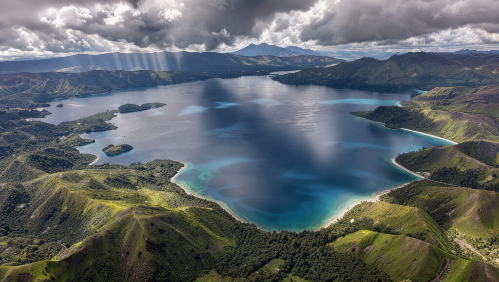
The lake fills a caldera. The GNS Science (geological research institute) Taupō Volcano fact sheet describes Lake Taupō as the lake filling the caldera of Taupō Volcano.
Quoting one depth figure means quoting one survey. The deepest point is recorded at 160 m, 164 m or 184 m, so each number is only as strong as the survey behind it, and the sources reviewed do not name a lake-wide survey.
The implication: a single depth figure without a named survey is a claim, not a measurement. Treat 160 m, 164 m and 184 m as three answers from three sources until a documented bathymetric survey settles the question.
What this means: a depth quoted without a named survey is one source’s answer, not a settled figure for the whole lake.
Is it safe to swim in Lake Taupō?
Waikato Regional Council (lake authority) describes the lake as clean and clear, with excellent water quality for swimming.
Taupō–nui–a–Tia (Lake Taupō) is a national treasure – a clean, clear lake, with excellent water quality for swimming and for the plants and animals that live in it.
Waikato Regional Council (lake authority)
That is a water-quality description, not a dated safety rating. The sources reviewed contain no current swim advisory, so this section does not grade today’s conditions.
How warm is the water in Lake Taupō?
- Measured water temperature: no value appears in the sources reviewed.
- Any figure needs a named measurement source and a date before it is published.
Has anyone swum across Lake Taupō?
- Documented crossing: none appears in the sources reviewed.
- Named event or record: none is verified, so this article makes no crossing claim.
Praise for water quality is not a swim-safety rating. Anyone heading into the water should check current council notices first, because none of the sources reviewed carries a dated advisory.
What this means: the swimming answer rests on a general quality description, and a safety call needs a dated council advisory.
Is Lake Taupō drinkable?
The sources reviewed do not give a drinking-water verdict for Lake Taupō.
Waikato Regional Council’s monitoring reports track nutrients and clarity, and those figures describe the lake’s condition rather than whether its water is safe to drink (Waikato Regional Council (lake monitoring report)).
- Total phosphorus, 2015–2019 average: 4.9 mg/m³ (Waikato Regional Council (lake monitoring report))
- Total nitrogen, 2015–2019 average: 87 mg/m³ (Waikato Regional Council (lake monitoring report))
- Total nitrogen, 1999–2003 deep-water mean: 70.3 mg/m³ (Waikato Regional Council (policy series))
- Secchi depth in individual sampling events: around 18–21.5 m (Waikato Regional Council (long-term monitoring report))
Secchi depth is a clarity measure, not a lake depth, so these figures do not answer the depth question.
Nutrient averages show how the lake is doing, not whether water drawn from it is safe to drink. A drinking-water verdict needs a cited test result or a public health advisory, and none appears in the sources reviewed.
The catch: a water-quality dataset is not a potability ruling, so the drinking question stays open until a public health source answers it.
Is there trout in Lake Taupō?
The sources reviewed do not confirm trout populations in Lake Taupō, and they do not set out the rules on selling wild trout.
Anyone planning to fish needs a named record for the lake, not a general claim. That record would have to come from a fisheries or conservation source, and none is in the research set.
Treat any trout or eel claim without a named record as unverified. The research for this article contains no Fish & Game New Zealand or Department of Conservation record for the lake.
The pattern: the trout question depends on fisheries records this research has not gathered, so it stays open here.
What animals are in Lake Taupō?
The sources reviewed do not confirm a species list for Lake Taupō.
Waikato Regional Council (lake authority) says the lake supports plants and animals, but the passage reviewed names no individual species.
- Fish: no species confirmed in the sources reviewed
- Eels: not confirmed for the lake in the sources reviewed
- Birds and insects: not listed, because no cited source covers them
The catch: “plants and animals” is a general statement, not an inventory, and a species list needs a named survey before it appears in print.
Confirmed facts and open questions
Confirmed facts
- Surface area: 616 km² (ILEC (international lake database))
- Surface level: 355.85 m to 357.20 m above sea level (Waikato Regional Council (lake authority))
- Water volume: 59 km³ (Waikato Regional Council (lake authority)) and 60 km³ (ILEC (international lake database))
- Origin: the lake fills the caldera of Taupō Volcano (GNS Science (geological research institute))
What’s unclear
- Lake-wide deepest point: 160 m (Waikato Regional Council (lake authority)), 164 m (ILEC (international lake database)) or 184 m (Department of Conservation (wetlands directory))
- Lake-wide mean depth: 91 m (ILEC (international lake database)) or 97 m (Department of Conservation (wetlands directory))
- Drinking-water status
- Current swim-safety advisory
- Water temperature range
- Whether any crossing has been documented
- Trout, eel and wider species records
For anyone planning a dive, a swim or a water sample at Lake Taupō, the choice is clear: quote a depth only with its named survey and date, or quote the 160–184 m range and say the official sources disagree. Waikato Regional Council and the Department of Conservation have published different figures, so a single number without its source misstates the official record.
Related reading: top tourist attractions and hidden gems · places to visit in Auckland
subsite.waikatoregion.govt.nz, waikatoregion.govt.nz, waikatoregion.govt.nz, waikatoregion.govt.nz, waikatoregion.govt.nz, waikatoregion.govt.nz, subsite2.waikatoregion.govt.nz, waikatoregion.govt.nz
Frequently asked questions
Is Taupō in Waikato or Bay of Plenty?
Taupō is in the Waikato region. Waikato Regional Council (lake authority) is the regional authority that publishes the lake’s official fact file.
Is Taupō a city?
Waikato Regional Council (lake authority) names Taupō District, not a city. The sources reviewed do not say whether the town holds city status.
What caused the Lake Taupō caldera to form?
The sources reviewed place the lake in the caldera of Taupō Volcano, as GNS Science (geological research institute) describes it. They do not describe the eruption that formed the caldera.
Is Lake Taupō the largest lake in New Zealand?
The sources reviewed include no national ranking of lakes by area, so this article does not rank the lake. Its surface area is 616 km², according to the ILEC (international lake database).
Why is the average depth lower than the maximum depth?
A maximum is the single deepest point, while an average is spread across the whole lake. The Department of Conservation (wetlands directory) gives 184 m for the deepest point and 97 m as the average over the lake’s entire area.
Why do the depth figures differ between sources?
The sources reviewed give different maxima and means and do not reconcile them. The ILEC (international lake database) lists 164 m and 91 m, and no supplied source explains the gap.
More related posts
 108 USD to NZD: Mid-Market vs Provider Rates Explained
 Google Tic-Tac-Toe: How to Play and Beat Impossible Mode
 Galaxy S8 to Buy – Prices and Value in 2024
 Kevin Belling Search Update: Missing Farmer Still Not Found
 The History of Sound 2025: True Story, Reviews, Watch Guide
 Cheap Gas Near Me: Driver-Reported Fuel Prices in Ireland
 6 Weeks From Today: Date, Days & Milestones
