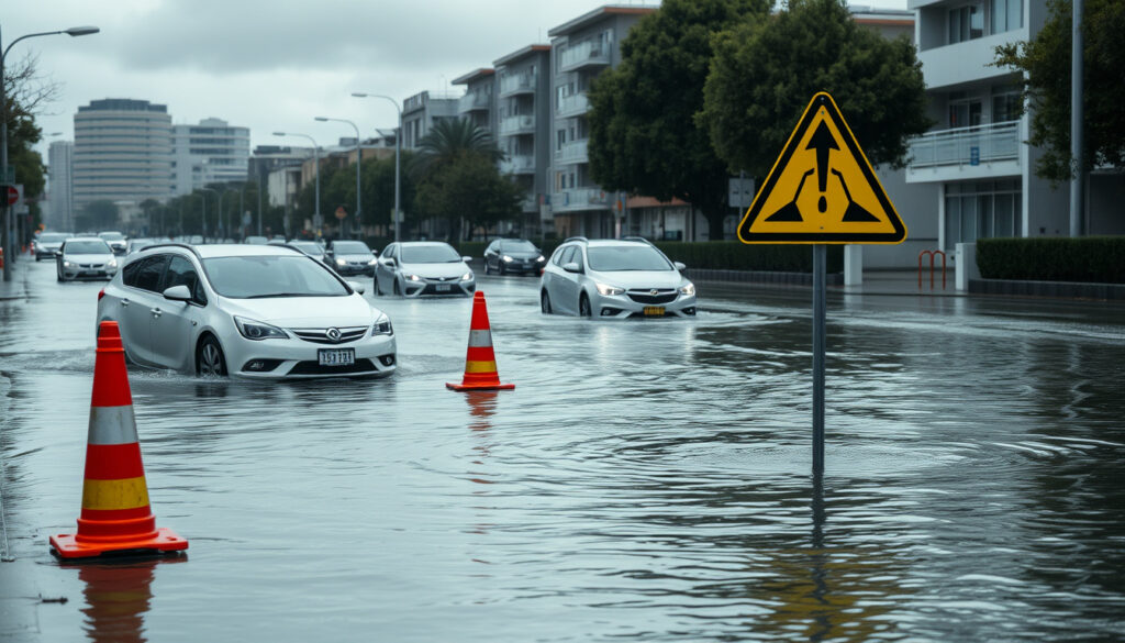
Flooding in Auckland Today: Official Alerts and Safety Advice
There is a moment, when the sky opens over Auckland, that thousands of people reach for their phones and search “flooding in Auckland today.” The results are not always what they seem: a UK flood alert for “West Auckland” in England can sit right above genuine local updates, and Auckland Emergency Management’s official page — updated 2 October 2026 — currently lists no active alerts for the region. The gap between the search results and the official record says a lot about how Aucklanders should prepare for the next real storm.
Active alerts in Auckland: None listed (Auckland Emergency Management,2 Oct 2026) ·
Latest confirmed Orange warning: Auckland north of Whangaparāoa (Auckland Council, 26 Mar 2026) ·
Rain forecast then: 90–120 mm (Auckland Council) ·
Recent flood alert: Warkworth / Mahurangi River (RNZ)
Quick snapshot
- No active Auckland alerts are listed on the Auckland Emergency Management (the region’s official civil defence agency) severe-weather page as of its 2 October 2026 update.
- A “West Auckland” flood warning surfacing in search results is for West Auckland in County Durham, England — not Auckland, New Zealand (UK Environment Agency flood service, England’s official flood warning system).
- In the most recently reported event, a flood alert was issued for Warkworth and the Mahurangi River swelled (RNZ, New Zealand’s public broadcaster).
- Whether new rain bands will trigger fresh warnings before the next official update to the Auckland Emergency Management severe-weather page.
- The full extent of damage from the Warkworth flooding, including when the Hibiscus Coast Highway slip will be fully cleared (RNZ).
- Which “Auckland” results in any search are live local alerts versus geographically mismatched ones — the County Durham warning is the proof (UK Environment Agency flood service).
- 21 Jan 2026: Auckland Council told residents to stay up to date as watches and warnings crossed the upper North Island (Auckland Council).
- 26 Mar 2026: An Orange Heavy Rain Warning was issued for Auckland north of Whangaparāoa, with 90–120 mm forecast (Auckland Council).
- Aug–Oct 2026: RNZ reported upgraded Orange warnings for the upper North Island, with up to 100 mm expected (RNZ).
- Check the Auckland Emergency Management severe-weather page — it is the only verified live source in this story.
- Slip repairs and road assessments, including the Hibiscus Coast Highway at Hatfields Beach, wil continue after rain eases (RNZ).
- Before acting on any “Auckland flooding” alert, confirm whether it says New Zealand or England — the confusion is already happening (UK Environment Agency flood service).
Nine checkpoints, one pattern: the official record is quieter than the search results suggest.
| Checkpoint | Verified status |
|---|---|
| Latest AEM update / alert status | 2 October 2026 — no active Auckland alerts listed (Auckland Emergency Management) |
| March 2026 warning level | Orange Heavy Rain Warning, Auckland north of Whangaparāoa (Auckland Council) |
| Rain forecast for that event | 90–120 mm on top of rain already received (Auckland Council) |
| Recent event rain expectation | Up to 100 mm, with rates up to 40 mm/h possible (RNZ) |
| Flood alert location (recent event) | Warkworth, Mahurangi River (RNZ) |
| Road closed (recent event) | Hibiscus Coast Highway, Hatfields Beach to Waiwera (RNZ) |
| Jan 2026 official guidance | Stay up to date and take care during storm conditions (Auckland Council) |
| 2023 warning guidance | Surface flooding, rapidly rising streams and rivers, slips, hazardous driving (Auckland Council) |
| “West Auckland” search result | UK Environment Agency warning for County Durham, England (UK Environment Agency flood service) |
What are the common natural disasters that affect Auckland?
Auckland’s hazard menu is shorter than many cities’, but the items on it are vivid: storms and floods, earthquakes, volcanic activity, and tsunami risk for the coast. Weather dominates the emergency records.
Flooding and storms
- Auckland Council’s 2023 warning guidance lists the classic flood impacts: surface flooding, rapidly rising streams and rivers, slips, and hazardous driving (Auckland Council).
- The March 2026 event showed the storm side of the pair: heavy rain and strong winds under a deep sub-tropical low, with an Orange Heavy Rain Warning for areas north of Whangaparāoa (Auckland Council).
The connection between the two is rainfall intensity. When a sub-tropical low ishes humid air over Auckland’s ranges, the same terrain that makes the city green also conentrates runoff into the streams and suburbs below.
A warning about “rapidly rising streams and rivers” is not boilerplate. In the RNZ-reported event, rain rates of up to 40 mm/h were flagged — enough to turn a small urban stream into a hazard within the hour (RNZ).
Earthquakes and volcanic activity
- Auckland sits on the Auckland Volcanic Field, and the region’s geology includes fault lines that can produce earthuakes, though these are less frequent triggers of emergency responses than weather.
The volcanic field is part of why Auckland’s emergency planning goes beyond storms. No volcanic activity warnings are listed in the official notices reviewed for this article, and the current risk picture is a weather story, not a geological one.
Tsunamis
- Coastal Auckland carres a tsunami risk, which is why evacuation routes and coastal warning systems are part of the region’s emergency framework.
On a day like today, tsunami is not the active risk — but it is part of the same “what can happen here” list that makes official channels worth bookmarking.
The pattern: Auckland’s hazard list is long, but the trigger that actually fires is almost always weather. The city’s most disruptive recent events — including the March 2026 storm and the 2023 Auckland Anniversary Week-end floods — were all rain-driven.
What are the current natural disaster risks in New Zealand?
Searching “flooding in Auckland today” returns a noisy results page; the official answer is quieter.
Current flood warnings for Auckland
- Auckland Emergency Management’s severe-weather page, updated 2 October 2026, lists no active alerts for Auckland (Auckland Emergency Management, the region’s official civil defence agency).
- Some of the most prominent “Auckland flooding” results are not from New Zealand at all: the UK Environment Agency’s live flood map currently shows a warning for “West Auckland” in County Durham, England (UK Environment Agency flood service, England’s official flood warning system).
That mismatch matters. A person checking quickly could see a flood warning on a map labelled “West Auckland” and assume their suburb is at risk. The official local record, however, shows no such alert.
The same search that shows a live UK flood warning for “West Auckland” also buries the official Auckland record. Anyone relying on search results instead of the AEM page is one click away from acting on the wrong hemisphere’s alert.
Severe weather alerts
- In the most recently reported upper North Island system, Orange Heavy Rain Warnings covered Northland, Auckland, Coromandel Peninsula, Bay of Plenty and parts of Tai Rāwhiti (RNZ, New Zealand’s public broadcaster).
- Forecasters expected up to 100 mm, with rain rates potentially reaching 40 mm/h (RNZ).
- MetService issues New Zealand’s official weather warnings, which Auckland Emergency Management then relays and acts on (MetService, New Zealand’s national weather service).
Based on the latest official update available, none of those Orange warnings is currently listed as active for Auckland. The gap between them and today’s search results is the whole story: warnings expire, search results do not.
Volcanic alerts
- No volcanic activity warnings are listed alongside the weather notices reviewed for this article.
For a “what’s risky right now” check, the active layer is weather, not geology. That can change without notice — which is why monitoring official channels maters even when the page is quiet.
The implication: “current risk” in New Zealand is a layered answer — the active layer is weather, the background layer is geology, and the only source that seprates them reliably is the official one.
What is the current weather news for New Zealand?
The current weather news for New Zealand has two layers: what happened in the recent storms, and what is active right now.
Heavy rain and gales lashing North Island
- RNZ reported upgraded Orange Heavy Rain Warnings for Northland, Auckland, Coromandel Peninsula, Bay of Plenty and parts of Tai Rāwhiti during the upper North Island event (RNZ, New Zealand’s public broadcaster).
- Up to 100 mm of rain was expected in affected areas, with rates potentially reaching 40 mm/h (RNZ).
That was the recent news. The current picture, per the latest official update, is quieter: Auckland Emergency Management’s severe-weather page lists no active alerts. In other words, the weather news today is the absence of a live warning — not the same as no risk.
Auckland flooding updates
- A flood alert was issued for Warkworth during the recent upper North Island event, and Auckland Emergency Management general manager Adam Maggs said the Mahurangi River was swollen (RNZ).
- The March 2026 Orange Heavy Rain Warning for Auckland north of Whangaparāoa prompted Auckland Council to urge residents to stay safe amid heavy rain and strong winds (Auckland Council, the city’s local government).
The flooding pattern in both events clustered north of the Harbour Bridge — Warkworth, the Mahurangi River, the Hibiscus Coast. That is useful context for anyone watching the sky in the northern suburbs: when Auckland floods, the north tends to feel it first.
Power outages and road closures
- The Hibiscus Coast Highway was closed between Hatfields Beach and Waiwera after a slip, with traffic management in place and an assessment underway (RNZ).
- The official notices reviewed for this article do not report widespread power outages in Auckland today.
Road closures, not power cuts, have been the signature impact of the recent events. For drivers, that means treating live road information as a flood early-warning system — see our Auckland Motorway Crash Today: Live Traffic & Safey Guide and Auckland Motorway Crash Today: Live Updates & Delays for current closures.
The pattern: the template for a live Auckland flood is already on the record — a heavy rain warning, a swollen river, a closed coastal highway. Seeing the same names recur is not coincidence; it is geography.
What are some of the extreme weather conditions in New Zealand?
New Zealand’s weather runs from subtropicall storms to aline frost — often in the same week.
Cyclones and tropical storms
- The March 2026 storm that hit Auckland was driven by a deep sub-tropical low — the same family of systems that draws tropical cyclones toward New Zealand during summer (Auckland Council).
New Zealand does not get hurricanes in the Atlantic sense, but it regularly catches the remmants of tropical cyclones. Those systems arive with the warmest sea-surface temperatres of the year, typically between December and April, and they are the most likely source of Auckland’s worst rain events.
Heavy rainfall and flooding
- The 2023 warning guidance from Auckland Council lists surface flooding, rapidly rising streams and rivers, slips, and hazardous driving as the expected impacts of heavy rain (Auckland Council).
- The RNZ-reported event flagged rain rates up to 40 mm/h — the intensity that overwhelms urban drainage (RNZ).
Heavy rainfall is the most common extreme weather trigger in New Zealand. The numbers explain why: Auckland Council forecast 90–120 mm for northern Auckland in March 2026 (Auckland Council), and RNZ reported up to 100 mm for the upper North Island event (RNZ) — and when those totals arive in hours rather than days, they become floods.
Rain rates of 40 mm/h were flagged in the recent event — the threshold where Auckland’s urban streams start behaving like open channels. When rates hit that level, expect loccalised surface flooding within the hour.
Snowstorms and frost
- Extreme cold is a southern and inland event: snowstorms and frost affect the South Island and central North Island in winter, while Auckland’s coastal climate stays comparatively mild.
For an article about Auckland today, snow is a footnote — but it rounds out the picture of a country where the weather can range from tropical rain to alpne snow within a single flight.
The trade-off: the same weather systems that keep New Zealand green also make it dangerous. A storm that drops 100 mm on Auckland in a day is both a routine climate event and a genuine hazard — the difference is preparation.
What is the deadliest natural disaster in New Zealand?
New Zealand’s deadliest disasters put Auckland’s flood anxiety in perspective.
The 1931 Hawke’s Bay earthquake
- The 1931 Hawke’s Bay earthquake killed 256 people — the deadliest natural disaster in New Zealand’s recorded history (Wikipedia, the collabrative encyclopedia).
That single event remains the benchmark against which all other disasters in the country are measured, and it is the reason New Zealand’s building codes and emergency management are as strict as they are today.
The 2023 Auckland floods
- The 2023 Auckland Anniversry Week-end floods caused widespread damage and loss of life, and they are the immediate background to today’s flood searches (Wikipedia, the collaborative encyclopedia).
January 2023 changed how Aucklanders hear rain. The anniversary week-end disaster is the reason a phrase like “flooding in Auckland today” gets searched at all during a storm.
Why this matters: New Zealand’s deadliest disaster was an earthquake, but its most emotionally recent ones have been floods. Aucklanders’ rain anxiety is not paranoia — it is history with a weather app.
Timeline: how the recent alerts unfolded
Dated signals, from the first official notices to the UK false positive:
- — Auckland Council tells residents to stay up to date and take care as rain and wind watches and warnings cross the upper North Island (Auckland Council).
- — A deep sub-tropical low brings heavy rain and strong winds; an Orange Heavy Rain Warning is issued for Auckland north of Whangaparāoa, with 90–120 mm forecast (Auckland Council).
- August–Octber 2026 — RNZ reports upgraded Orange Heavy Rain Warnings for the upper North Island and a flood alert for Warkworth; the Mahurangi River swells (RNZ).
- Same event — The Hibiscus Coast Highway closes between Hatfields Beach and Waiwera after a slip, with an assessment underay (RNZ).
- — Auckland Emergency Management updates its severe-weather page with no active alerts listed for Auckland (Auckland Emergency Management).
- — The UK Environment Agency’s flood map shows a “West Auckland” warning in County Durham, England — a result that keeps surfacing in Auckland, New Zealand searches (UK Environment Agency flood service).
The pattern: every genuine Auckland flood event in this timeline followed the same sequence — a heavy rain warning, loccalised flooding, closed roads, and a long tail of repairs. Today’s mixed-up search results are just the echo.
What’s confirmed, what’s still unclear
The verified record is thin on active alerts and thick with open questions. Here is the honest balance sheet.
Confirmed
- Auckland Emergency Management’s severe-weather page lists no active Auckland alerts as of its 2 October 2026 update (Auckland Emergency Management).
- A flood alert was issued for Warkworth during the recent upper North Island event, and the Mahurangi River swelled (RNZ).
- The “West Auckland” flood warning appearing in search results refers to West Auckland in County Durham, England (UK Environment Agency flood service).
Still unclear
- Whether new rain bands will trigger fresh warnings before the next update to the official page (Auckland Emergency Management).
- The full cost of damage and the repair timeline for the recent upper North Island event, which has not been published yet (RNZ).
- Whether any casualties occurred in the recent events — the official notices reviewed for this article do not mention any.
- When the Hibiscus Coast Highway slip will be fully cleared; an assessment was still underway when RNZ reported the closure (RNZ).
With no active alerts, the uncertainy list is longer than the confirmed list. That is exactly why the official page — not the search page — should be the source of truth.
What officials are telling residents
Three statements capture the current record: the council’s written guidance, the emergency agency’s on-the-grund assessment, and the public broadcaster’s report.
“Auckland weater: stay up to date and take care.”
Auckland Council’s official storm notice, January 2026 (Auckland Council, the city’s local government)
“The Mahurangi River was swollen.”
Adam Maggs, general manager of Auckland Emergency Management, on the Warkworth flood alert, as reported by RNZ (RNZ, New Zealand’s public broadcaster)
“Heavy rain for upper North Island; avalanc risk ongoing for South Island.”
RNZ’s report on the upper North Island heavy-rain event (RNZ)
The through-line: officials consistently ask residents to stay up to date and take care — and the one message that never changes is to check official channels before acting.
What this means for Aucklanders
Searching “flooding in Auckland today” has become a reflex for thusands of Aucklanders, and the reflex is understandable — the city has genuine flood history, from the 2023 Anniversry Week-end disaster to the Warkworth alert in the most recent reported event (RNZ). But the verified picture right now is quieter than the results page suggests: no active alerts on the official record, and some of the loudest “Auckland flooding” results are coming from the wrong country. Preparedness for the next event starts with knowing which source to trust. For anyone living in a flood-prone Auckland suburb, the choice is clear: bookmark the Auckland Emergency Management severe-weather page and act on its warnings — or trust an algorithm that may show you a river warning for County Durham, England.
aucklandemergencymanagement.govt.nz, ourauckland.aucklandcouncil.govt.nz, ourauckland.aucklandcouncil.govt.nz, rnz.co.nz, ourauckland.aucklandcouncil.govt.nz, ourauckland.aucklandcouncil.govt.nz, rnz.co.nz
Frequently asked questions
Is there flooding in Auckland right now?
Based on the most recent official update, Auckland Emergency Management’s severe-weather page lists no active alerts for Auckland (Auckland Emergency Management). The closest recent flood alert was for Warkworth during the upper North Island event reported by RNZ (RNZ). For the live picture, check the AEM page rather than search results.
Which areas of Auckland are affected by flooding?
In the most recently reported event, the confirmed impacts were north of the Harbour Bridge: a flood alert in Warkworth, the Mahurangi River swelling, and the Hibiscus Coast Highway closed between Hatfields Beach and Waiwera (RNZ). The March 2026 Orange Heavy Rain Warning also targeted Auckland north of Whangaparāoa (Auckland Council).
How can I check if my street is flooded?
The official source is Auckland Emergency Management’s severe-weather page (Auckland Emergency Management). Be careful with search results: the UK Environment Agency’s current “West Auckland” flood warning refers to West Auckland in County Durham, England, not New Zealand (UK Environment Agency flood service). Check the country before you act on any alert.
What should I do if my home is flooded?
Auckland Council’s storm guidance is to stay up to date, take care, and treat warnings seriously: heavy rain can cause surface flooding, rapidly rising streams and rivers, slips, and hazardous driving (Auckland Council). Avoid driving through floodwater, stay clear of downed power lines, and monitor official channels for where to get sandbags.
Are any schools closed due to flooding?
The official notices reviewed for this article do not report any school closures in Auckland. During active flood events, schools announce closures directly to families and on their own websites.
Where can I get sandbags?
During storm events, sandbag availability is coordinated through Auckland Council and Auckland Emergency Management channels. The current notices reviewed for this article do not list an active sandbag distribution point, which is consistent with no active flooding alerts being listed (Auckland Emergency Management).
More related posts
 Calculate How Much House You Can Afford by Income
 Financial Markets Conduct Act 2013 Guide: Key Points
 iPhone 14 Pro Max Case: Protection & Compatibility Guide
 How Many Sick Days Per Year in NZ? 2024-2025 Guide
 Best Apps for Health 2026: Top Chronic Condition Picks
 Baby on the Move Grey Lynn: Car Seat Hire for Taxis & Uber NZ
 NZ Super Increase 2025 Latest News: April 2026 Rates Confirmed
 Broadband Speed Test NZ: How to Check Your Internet Speed
